Skip to content

How to customize colours on C-MAP charts with Custom Depth Shading

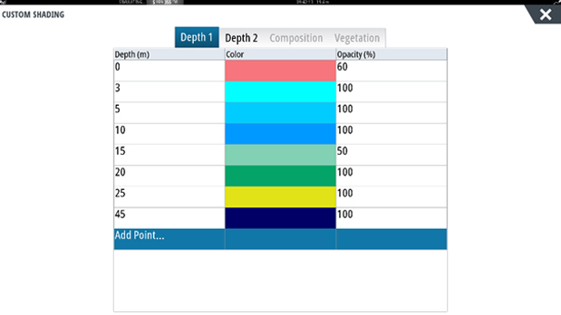
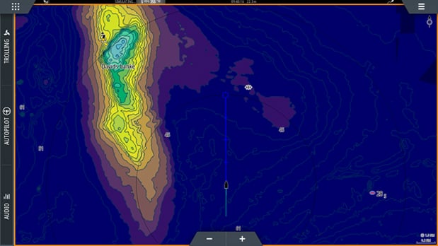
Quickly identify depth contours on your map by asigning a custom colour to a specific range. Depending on your angling gameplan, what fish species you are targeting, and what depths you think you think you’ll be able to catch ‘em, it is possible to highlight key areas to easily identify potential fishing locations.

Custom Depth Shading is a feature compatible with C-MAP MAX-N+ and Genesis Maps to enable you to customize the colours presented on your chart.

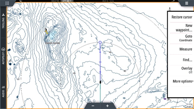
Here’s how to set up your own custom colour palette:

STEP 1 - Click on the menu button in the upper right corner, and then click on “More options” menu

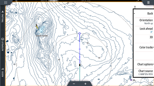
STEP 2 - Click on Chart options menu

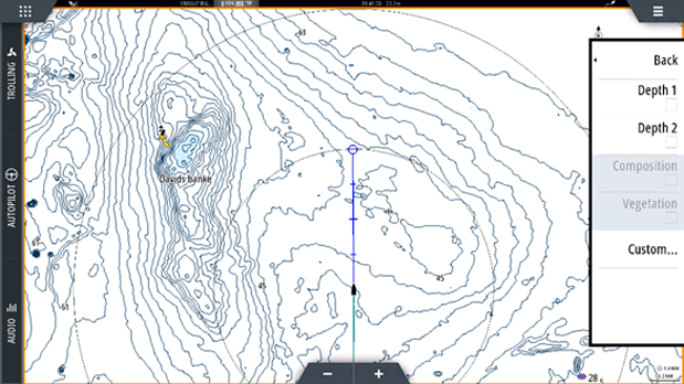
STEP 3 - Scroll down to Shading menu

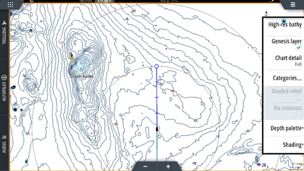
STEP 4 - Click on Custom menu

In the Custom Depth Shading menu, it is possible to select your own colour palette preference. Each meter interval gives you the option to select a custom colour - you can chose one colour for every meter interval. 

On the left-hand side of the screen is the depth range. The highlighted colour is applied to a selected depth value, down to the next line value. Depending on the area and situation, you might want to increase or decrease the intervals.

With the below Custom Depth Shading example, you will see how depth interval colours are displayed on the map.

0-3    meter = RED

3-5    meter = Blue

4-6     meter = Blue

5-10    meter = Blue

10-15  meter = Blue

15-20  meter = Light Green

20-25  meter Dark Green

25-45 meter Yellow

+45   meter Dark blue

Now, here’s how that custom colour palette displays on the chart. Structure and drop-offs can now be easily identified allowing you to locate key fish holding areas faster and with more accuracy. As an added bonus, Custom Shading also improves interpretation of the depth and structure detail e.g. step drop-offs with tight contour lines.