Back in 2018, C-MAP launched the Genesis Layer functionality for MAX-N+ inland water charts. This allowed anglers to overlay crowdsourced bathymetry from Social Map onto a MAX-N+ Chart.
C-MAP Genesis is a cloud-based service that empowers anglers to create custom, high-definition contour maps from sonar data recorded with a compatible Sonar/GPS unit from their own boats.
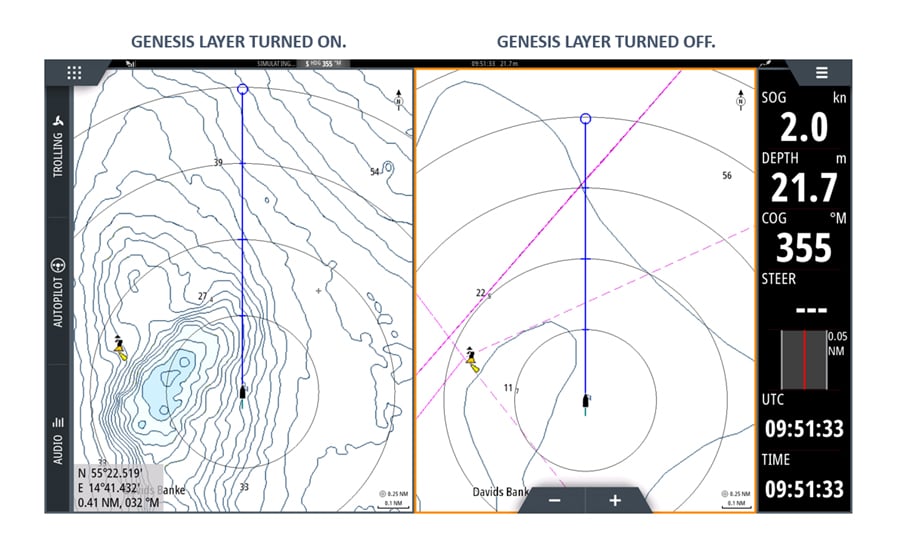
While a navigational chart is used for safe course plotting; taking the user from A-to-B, C-MAP Genesis provides the detailed bottom structure of a body of water - this data helps you identify those elusive fish holding spots.
The Genesis Layer is updated twice per year, where all the inland data currently available on Social Map is ingested into the C-MAP MAX-N+ charts. When the public update is completed, log into your www.gofreemarine account download the latest version.
How to activate the Genesis Layer on your Simrad device:
STEP 1 - GO TO MENU
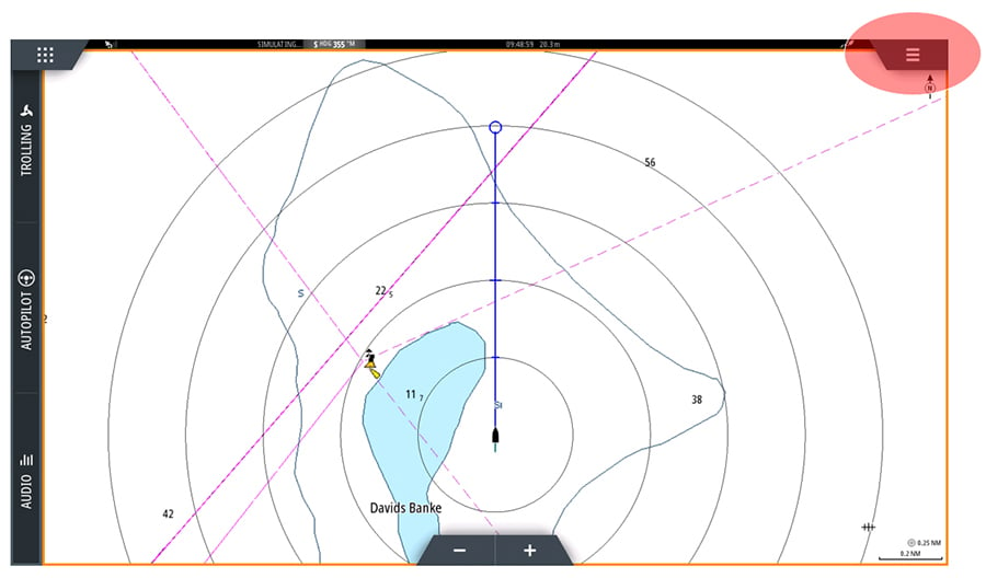
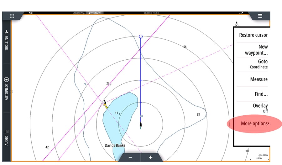
STEP 2 - GO TO MORE OPTIONS
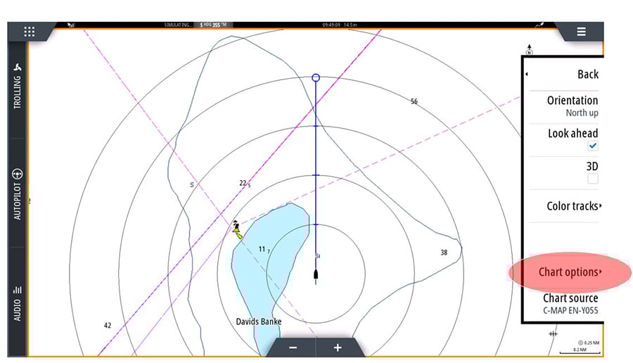
STEP 3 - GO TO CHART OPTIONS
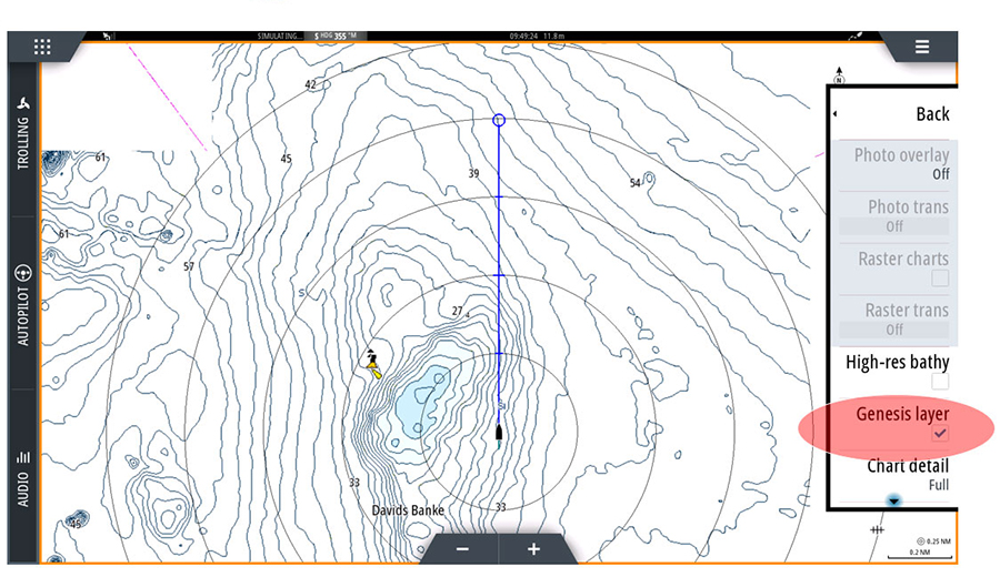
STEP 4 - SELECT GENESIS LAYER