Essential Simrad Chart Overlays for All Boaters
Simrad® chartplotters and fishfinders offer a variety of chart layers that enhance navigation, fishing, safety, and more. Some layers depend on your device model or require extra hardware or subscriptions. These real-time overlays provide the information you need to make smarter decisions and get the most from your time on the water.


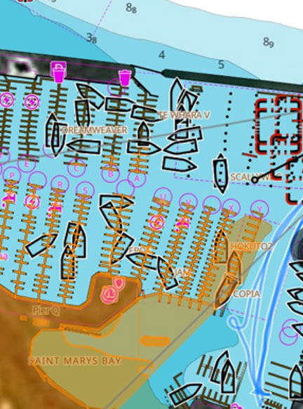
C-MAP Charting Layers
Satellite Overlay:
On C-MAP® REVEAL and REVEAL X charts, the satellite overlay offers a high-resolution, real-life view of your surroundings. This allows you to see coastlines, land features, and underwater terrain, enhancing your awareness when navigating unfamiliar waters or searching for new fishing spots.
C-MAP Safety Alerts:
Using real-time chart data, C-MAP Chart Safety Alerts notify you when you're approaching shallow water, restricted areas, or other potential hazards, helping you avoid dangerous situations like grounding or collisions.
C-MAP Genesis Social App:
Designed for anglers, the C-MAP Genesis Social App lets you share and access custom fishing maps, crowdsource fishing data, and discover popular fishing spots. Connecting with fellow anglers can give you insights into the best areas to fish, maximizing your time on the water.
Angling-Focused Overlays
Color Tracks/Heat Trails:
The Color Tracks overlay lets you visualize environmental changes like water temperature throughout your journey. By tracking temperature shifts, you can pinpoint spots where certain fish species are more likely to bite. This feature looks especially impressive on the Simrad® NSS® 4 display, providing clear, vibrant visuals that enhance your fishing experience.
C-MAP Genesis Bottom Composition:
The Bottom Composition overlay helps you identify underwater terrain types, like rocky or sandy bottoms, that may be more attractive to certain fish species, allowing you to focus on productive fishing grounds.
C-MAP Genesis Vegetation Overlays:
Fish are often drawn to areas with underwater vegetation, where they can find food and shelter. The Vegetation overlay helps you identify these spots, making it easier to find prime fishing locations.
SiriusXM® Fish Mapping:
With a subscription to SiriusXM using the SiriusXM WM-4, you gain access to real-time fish location data, water temperature trends, and more. This overlay helps you find the best fishing areas based on accurate, up-to-date information.


Weather and Safety Features
Simrad HALO Radar Overlay:
The Simrad HALO Radar overlay provides real-time radar data, helping you spot nearby vessels, obstacles, or weather conditions that could impact your journey. This feature is especially valuable in low-visibility conditions like fog or at night.
SiriusXM Weather Overlay:
Stay ahead of changing conditions with the SiriusXM weather overlay. Access real-time updates on weather patterns, storm forecasts, and wind conditions, helping you plan your route and make informed decisions about your journey.
AIS (Automatic Identification System) Overlay:
The AIS overlay gives you crucial information on nearby vessels, including their location, speed, and course. This enhances safety by allowing you to monitor surrounding traffic and avoid potential collisions, especially in busy or low-visibility conditions.
Simrad chart layers go beyond navigation to deliver valuable fishing, weather, radar, and safety data. These are just a few examples of the many overlays available to customize your boating experience. Explore your system to find the features that work best for you.
Certain C-MAP layers require the REVEAL or REVEAL X upgrade. SiriusXM requires the SiriusXM WM-4 module and subscription. Radar requires HALO radar installed and integrated with the device. AIS transponder needed for AIS Overlay.